Riding to BTH - a virtual tour via photographs, now with 96% less effort required!
I thought it would be interesting to show you some of the landscapes I ride through each morning on my way to work. This not only will provide you with an idea of what sort of area Blekinge is, but if I remember to repeat this exercise later in the year, it will be a way to show the effect of the seasons on Ronneby. That's an if, not a when. It is also a way to view my journey from the comfort of your computer screen, without having to move any pedals or change gears. Sit back and enjoy the ride.
This first photo is of the edge of the set of apartment blocks at Hjorthjöden, looking down towards the long sloping road that takes you towards the city.
 Here is a view from near the top of that sloping road. As you can see, most of the surroundings are forest, with the occasional road and street sign thrown in for good measure. (Speaking of street signs, one of the most amusing from an English point of view is at BTH, where it says Farthinder. No, it's not a way to stop flatulence! It means speed bump.)
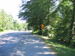
One makes a sharp right turn part way down the hill. Along this street is where I have seen the deer, since there is quite a lot of forest. The western end of the street is relatively flat compared to the eastern end. The eastern end is where the more conventional housing starts. 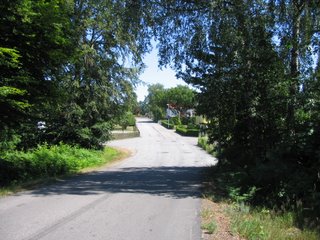 It's hard to get an idea from this next photo, but at the eastern end of the street is a very steep slope downwards. This is great fun to ride down in the mornings, but a real pain when riding up the slope in the evenings. In the distance, you may be able to see the crane at the construction site at Vidablick.
 Speaking of cranes at Vidablick, here it is. Vidablick is a sjukhem, some kind of hostel.
 Continuing in an easterly direction, behind Vidablick, there is a gravel path. This path leads to the edge of Brunnsparken. For more information, see http://www.ronneby.se/publicweb/templates/WidePage.aspx?id=4809 It is here where you really feel like you are out in the country, even though you are only about a kilometre away from the centre of town.
  This photo was taken further along the same path. This is another place where it slopes down towards the east, but it is not obvious from the photo. At centre left, you may be able to see the sign indicating one of the entrances to Brunnsparken. Also interesting is that there are streetlights along this path, and there is a paddock on the right hand side.
 Here is a view into that paddock. Yes, it seems the sheep here get streetlights. Maybe they like to read? Anyway, I think it's cute that they have a little bridge built for them so they can cross the pond.
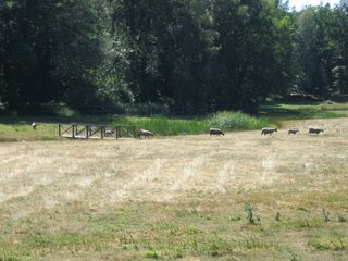 At the end of that gravel path, one comes to a T-junction. Looking eastwards, the view is as shown below. There are plenty of rocks and trees. This environment is perfect for frogs. I often see baby ones about 2cm long trying to hop out of the way of my rapidly approaching bicycle tyres.
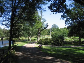
Finally, making a left turn and following the winding path down the hill, one is confronted with this glorious view. At the moment, there are plenty of ducks and ducklings about in the ponds. After a minute or so riding basically straight ahead, one reaches the Ronnebyån, and on the other side is BTH.
posted by Bruce @ 3:33 pm
![]()

<< Home