Skär am I going now?
There was a place I had been wanting to get to for many weeks. It was a big blue area on the map between Ronneby and Kallinge. Its name was Skärsjön. I am translating this as Rocky Lake. This is another of the incredible powers of the letter S in Swedish. To give you an idea of how this is pronounced, it's something like Where-whurn, hence the title of this post.
Anyway, I had been to Kallinge and other areas a few times, but had never made it to this lake. I decided to fix that by going there especially. There were no paths or roads around it, so I decided to go on foot. I headed north from the centrum along Kallingevägen for a bit. I remember hearing a different sound from the cars as they zoomed by. This was because people were changing over to their winter tyres, which make a slightly more metallic sound on the road.
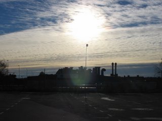
Here is a photo of some of the industrial area of Ronneby taken from Kallingevägen under a mix of cloud and sun.
 The only road to Skärsjön is the one under the E22. This is reached from the suburb of Kalleberga Hallar. This is a photo of the underpass.
 The lake is actually a public fishing area. Here is the noticeboard there. I think it talks about needing a fishing license to fish there and when you can fish.
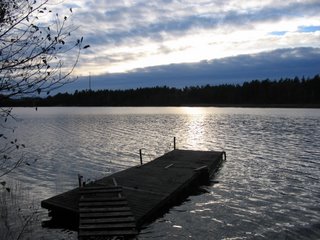
 This is the main jetty at the lake. I tried to put together a panorama shot, but it didn't quite work, due to the flat gate structure being photographed from different angles.
 Yes the water was blue, but a lot of the surroundings of the lake were brown and orange, due to all of the fallen leaves. There was some green though, like these mosses.
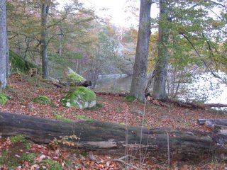
And here is a wider shot of a large log by the edge of the lake.
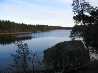
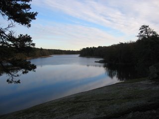
My aim was to circumnavigate the lake. There were bits of trail here and there, but in some places it was difficult to get through. Most of the northern end had a fairly visible path though, and some great places to get a nice photo. Here are some examples. Note particularly the reflections of the sky in the surface of the water.


Traversing the eastern side of the lake was much more difficult. There were lots of pokey branches everywhere and I could not find a clear path. Here's a view from that side.

This is a broken old jetty.

And another one in slightly better condition.
The sun was starting to set already, so I had to hurry. Here is a small bridge located in the southeast part of the lake surroundings. The existence of the bridge made me realise that there probably was a walking track somewhere around the lake.

And here it was. I had seen red markings on some of the trees as I went around, just like this one.
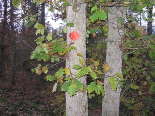
This was to guide people safely all the way around the lake. A shame I only realised this almost at the end of the journey. The path actually goes up along the barrier of the E22. I followed it along and then back down to the underpass, and then back home to Hjorthöjden.
posted by Bruce @ 12:40 am
![]()

<< Home