A Little More Than A Stone's Throw Away
The next journey was probably the longest of my time here. I had read online that there was an ancient ruin located in Blekinge called the Björketorp (which I'm translating as Birchcroft) stone. I was hooked and made it my mission to find it. The details I could find online were sketchy at best. One source said it was near Yxnarum and Listerby. I had been to both of those towns a few weeks before, but I had not seen any big stones. It seemed that people writing on the internet wanted to keep its location a secret. I even downloaded a runestones database in an attempt to gain more clues. I could find a picture of the ruin, but no directions as to how to find it. Eventually I found one page saying that it was about 500m along a road heading to Tving (I love that name!) from the E22 highway. Well that was close enough for me. Armed with that information, I set out to find it.
To get there, I was going to have to go back to the place where I went the wrong way along Gärestads Bygata a few weeks before.
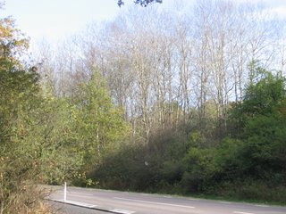
Here are some of the trees which had turned bare with Autumn in full swing at the Hamnvägen crossing in eastern Ronneby.
 Here are the trees viewed from Pilfinksvägen. I had taken a similar photo on the Yxnarum journey. You may be able to see that the trees are barer and less green in this photo.
 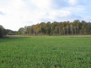 Upon reaching the spot where I had turned around the previous time, this time I pressed on. I followed Gärestads Bygata around, and then turned at Hamrabacksvägen. Just before this road passed under the E22, I passed a man with a large rifle. He was out shooting something. First rifle I'd seen in Sweden. Just on the other side of the underpass, there was a guy in a tractor doing some major work on this field.
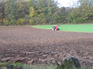 From there, I took Edestadsvägen on my journey northeast. The roads up here were quite deserted in comparison to Gärestadsvägen, which I was thankful for. Here are some of the green fields
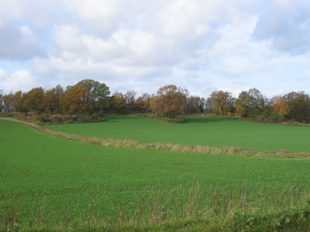 and here is a whole lot of hay.
 Eventually I reached the western entrance of Edestad, complete with a familiar blue sign.
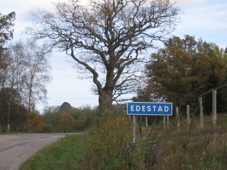 A few internet sites had mentioned the church at Edestad. Well, this is it. The cemetery is off to the right.
 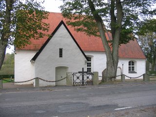 The thing which most caught my eye, however, was this structure on the other side of the road, opposite the church. It only seemed to have one small entrance, and although it was quite tall, it didn't look like it could hold very much. If anyone has information on what it is, I would be most grateful.
 Here is another view of it, from further back.
 Eventually, I reached Tvingvägen, but quite a distance north of where the Björketorp stone would be. Turning left, and heading north, I came across this brilliant specimen on the side of the road. It almost looks like one from the Smurfs.
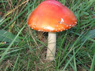 A little further on, I saw this information booth. It says Hjortsberga gravfält (something like Deer's Rock gravefield). It's part of something called Johannishusåsen (Johannishus Ridge), a huge nature reserve. This was one of its many attractions.
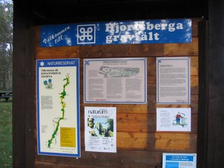 Strangely enough, there was another of those pointed wooden structures nearby.
 Here it is from a different angle. It's quite near to the railway crossing.
 Here are some of the very sparsely placed trees.
 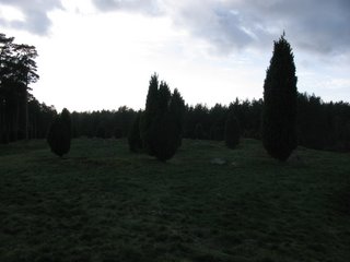 And here is Hjortsberga church, again just opposite the pointy wooden structure.
 Continuing along, I came to the town of Johannishus. It would be in the list of the ten largest towns in Ronneby Kommun, but it is much smaller than Kallinge. It was fairly quiet, but I did meet some horses along the side of Listerbyvägen. One at the front even has a cute blanky on. Unfortunately, I think I caught the one at the back at an inconvenient moment.
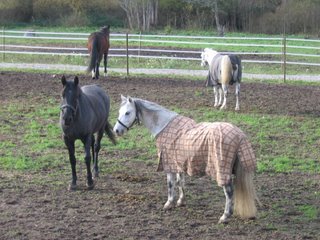 Johannishus is large enough to qualify for its own ICA store. I sat at the bus stop outside of it and ate my pre-packed lunch. Well, I had seen Johannishus. It was time to find the Björketorp stone. And I needed to hurry, as it was the first day of non-daylight savings, so I had an hour less of afternoon sun.
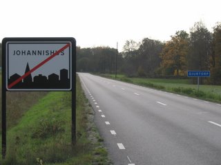
Here's the "you are now leaving Johannishus" sign, and the sign for the almost nonexistent village of Djurtorp (Animal Croft) in the background.
 Animal is right. Here is a cat, chasing something just by the side of Johannishusvägen.
 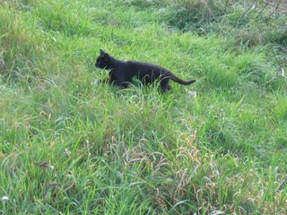 I tried to reach Tvingvägen again from the E22. However, there is no bike lane on the north side of the road, so I had to find another way. The road I ended up taking is not named on Google or Eniro maps, so I can't give you a name. It was more of a trail than a road, running behind a few barns. I did however see yet another one of these structures. They resemble an umpire's chair in a tennis match. I've seen a few around in different places, but I don't know what their purpose is. Again, if anyone has info, please let me know as it has been puzzling me.
  Eventually I made it to Tvingvägen, but I believed I was still too far north. So I headed south towards the E22. I found a sign pointing to Björketorp, so I knew I was close to the target. I however made the stupid move of following the sign. It points to the town, not the stone.
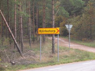 After riding around on the bumpy roads there for a while, seeing sights such as this one of something being covered by a huge sheet weighted down by tyres, I realised I was in the wrong place.
 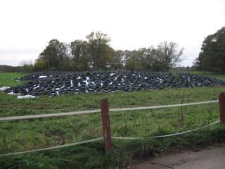 So, I yet again returned to Tvingvägen and headed further south. Eventually, success! Here's the information booth for the Björketorp stone, with a handy box full of brochures.
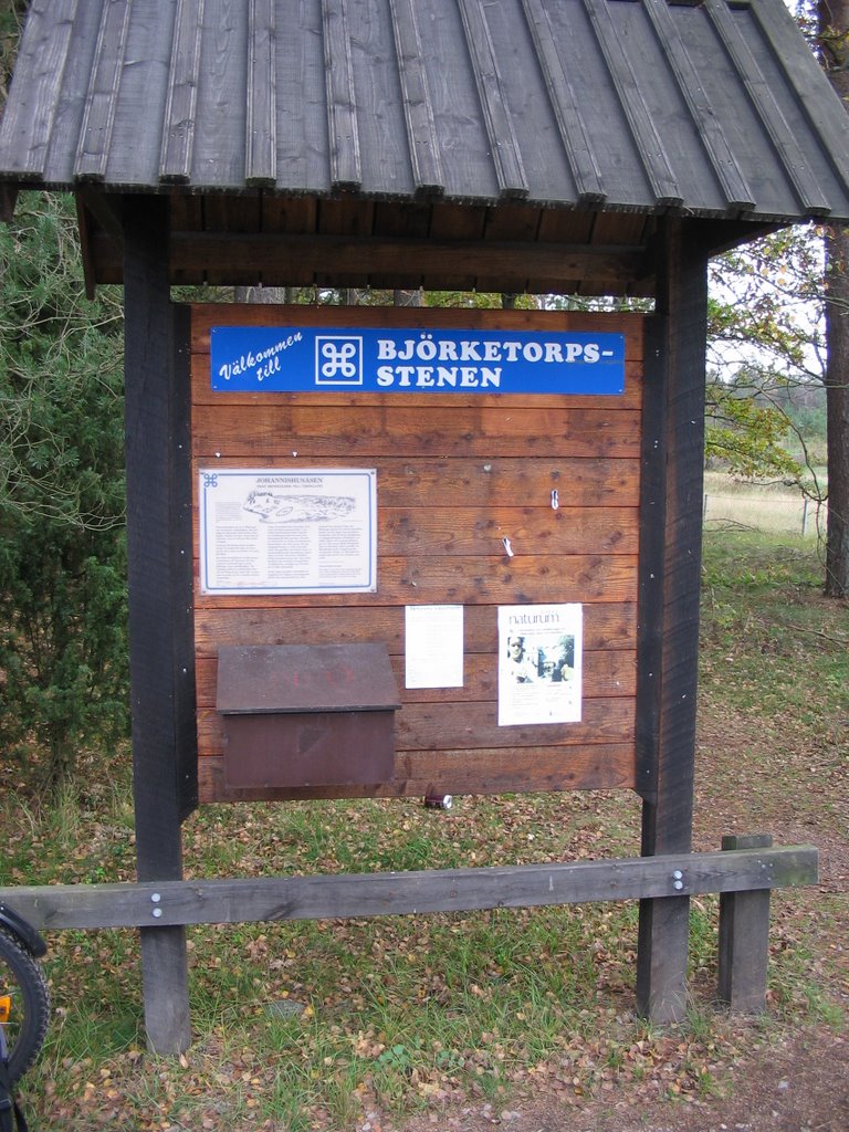 Here's an information sign about the stone and the surrounding ruins.
 And now, ROCKS!
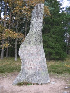
The main attraction is a set of three menhirs. Only one of them is marked with writings, from around 700AD. There are numerous translations of its meaning, but most say it is a curse. There are legends of a man who tried to move the stones as they were preventing him from farming that area. He was apparently subsequently stuck dead by lightning. Believe it...or not.
Thisis the one with writing, on the side which has the most writing.
 And a closeup of the writing.
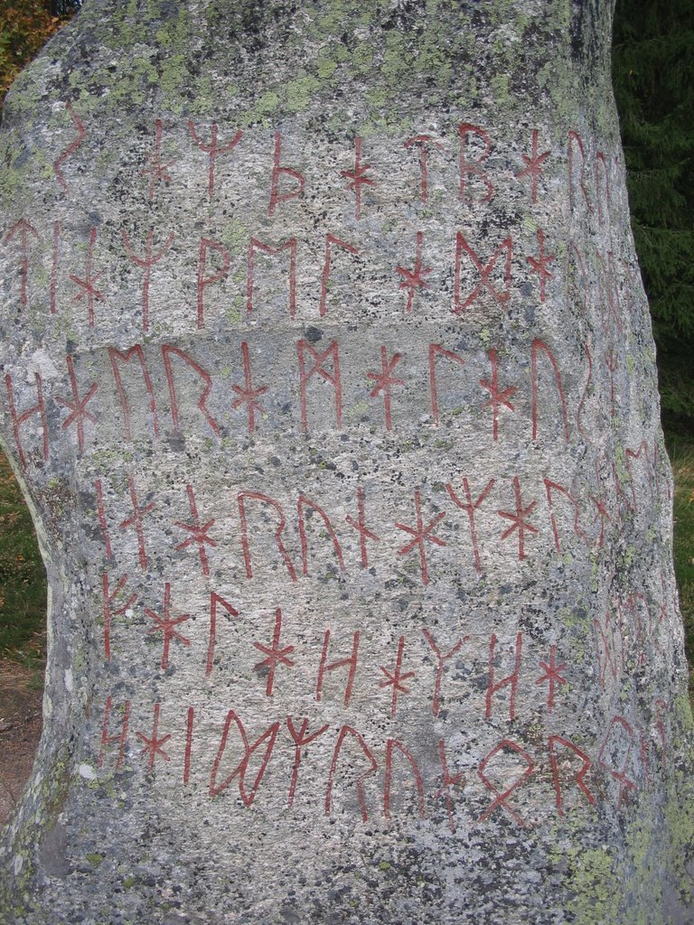 Here is the only writing on the other side of that stone.
 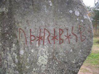 Here are all three stones.
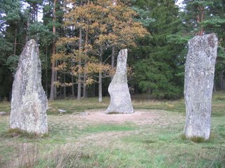 Here's me in front of the one with writing.
 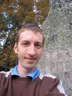 Just near the set of three, there is this line of smaller stones.
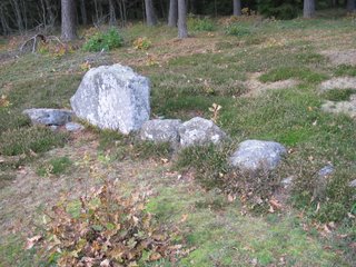 A view of the area from a distance.
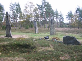 Another one of me.
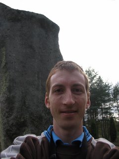 In addition, there is this set of seven stones arranged neatly in a circle formation just to the east of the other stones.
 And here you may just be able to make out the three menhirs in the distance, as seen from the circle of seven.
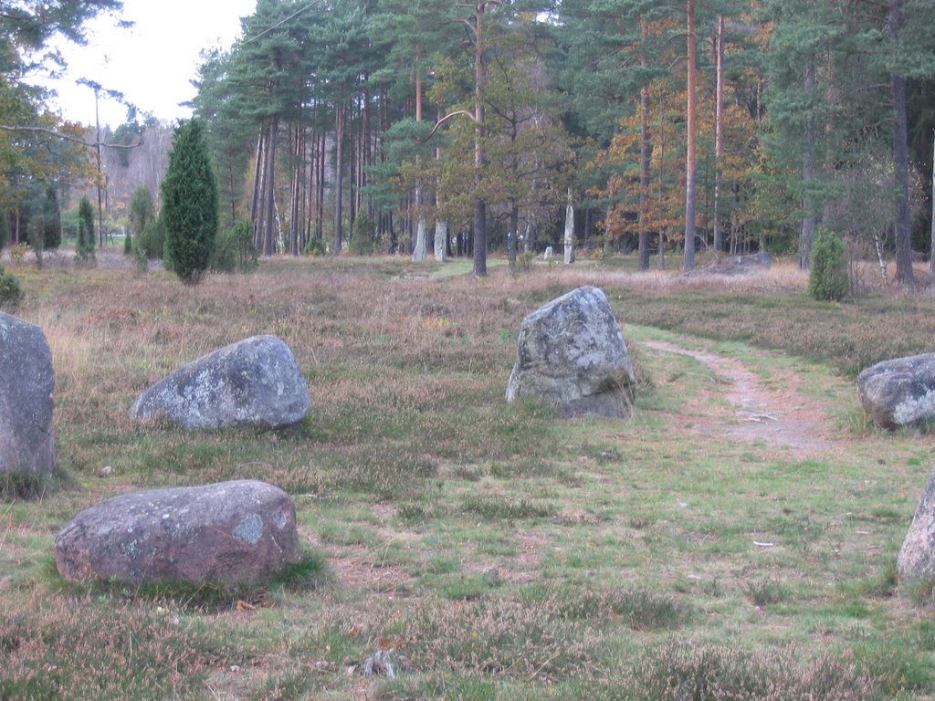 My last stop before heading home again back the same way I had come was the "Ishällen" or Ice Slab. However I'm not sure why it's called that. It's about 100m north of the Björketorp stone, and is a huge, fairly flat rock in the middle of the forest. Here is a closeup of some of the plant life growing in the puddles on the slab.
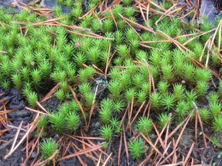 And finally, this is one side of the slab, looking back toward Tvingvägen.
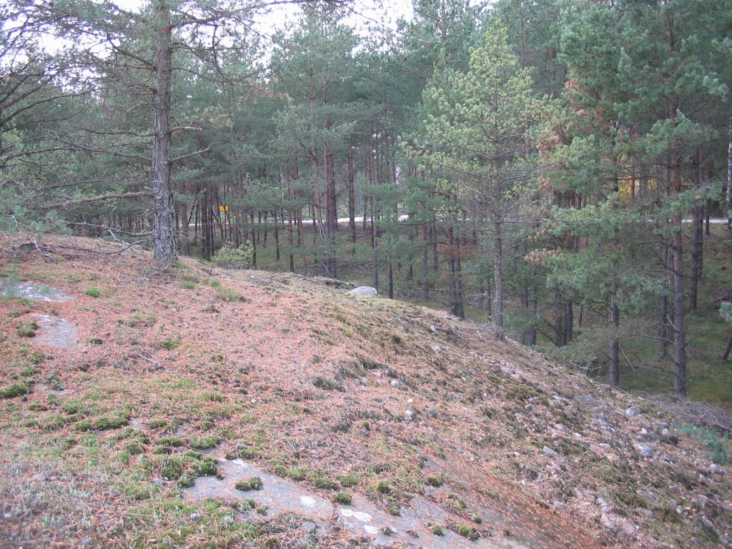
posted by Bruce @ 11:47 pm
![]()


<< Home