Sunsets and Slopes of Sörby on a September Sunday
As I mentioned at the end of my previous post, I had a puncture on my rear bicycle tyre. My bike was out of action for over a week. I in fact thought it had just gone flat. Thus, I took it back to the bike shop where I had purchased it and got it pumped up again. Alas, the following morning it was flat again. It took a few days to organise getting it repaired (as well as a few phone calls home in a flailing attempt to get help in fixing it myself). But 105SEK (about AU$20) later, it was all better. Whilst all of this was going on, another weekend of beautiful September weather was happening. I decided to take advantage of it. However, I was going to have to walk. So I decided to pick somewhere closeby where I had not yet been. The answer was Sörby, a suburb in northwest Ronneby.
How to get there:
Take Vierydsvägen north until you hit Västra Industrigatan and turn left here. As you might have guessed, this is the industrial area. Just before the bulk of the industrial stuff, there are still some houses. Here is one. If you look really closely, you can see a plane's vapour trail heading in the direction of the afternoon sun.
 After the intersection with Karlshamnsvägen (no prizes for guessing where that goes), the street becomes Gamla Landsvägen. It's pretty deserted up here, right up in the NW corner of Ronneby. I remember passing the Miljöteknik buildings. The road reaches a jackknife. The only other way out is to take Sörbyvägen. Part of this is a semi-fancy bridge over the currently non-functional railway line. Here it is, with the railway line stretching northward below.
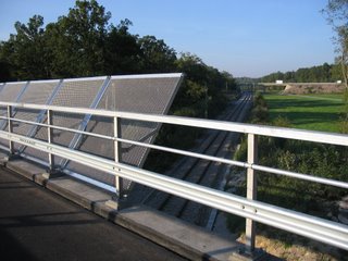 Here is one of the many "noticeboards" I've seen around here. Literally, it says something like Sörby community's association. Usually you see notices such as for sale, for rent, what's on at the local church etc.
  There are a couple areas in Sörby where you can look down on the surrounding area from above, although a lot of it is fairly flat. The next two photos show the view from one such rocky hill. I guess it's a little like a mini version of Snäckebacken.

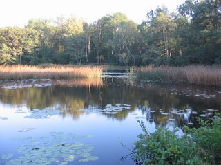
I saw on my map that there was a nearby tourist attraction called Silverforsens Kaffestuga, or The Silver Rapids Coffee Cottage (my translation). It looked fairly deserted, so I didn't go in. I also happened to notice there were a few bridges across the Ronnebyå just near here. So I tried to locate them. At the first place I tried, a young couple had just arrived home and well...my guess is they wanted some privacy...they also had a big guard dog, and I guess it wanted some privacy too, because it wouldn't stop barking. However I did manage to stick around long enough to snap this photo of the river at one of its widest points and heavily populated by rushes.
 I made my way back over the other side of Silverforsens and eventually I found one of the bridges. Here is the same part of the river, but viewed in the opposite direction. On the opposite bank is one l_a_r_g_e tree.
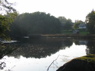 Following the path after crossing the bridge resulted in this view of the sun reflecting on the water.
 Further along the path, there is this bridge, which is much longer.
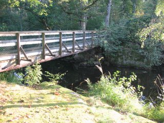 Upon crossing it, I placed my camera on the bridge's top edge to get a steady shot looking south down the Ronnebyå. This gives an idea of how 'foresty' it is around here.
 The bridges here had in fact inspired me to try to locate the other bridges acroos the river that I could see on my map. They were all basically at the sharp bend in the river, east of the Stadshus. This was quite a walk south from where I was, so I headed all the way down Sörbyvägen, and turned left at the second roundabout. I went behind Maxi, along Gamla Karlshamnvägen, and up this extremely narrow road, Trollabackvägen or something similar. Following it around to Bruksvägen, I found another one of those rocky hills like the one in Sörby. Here is a panorama of the view from there, including Maxi supermarket near the right hand edge.
 Here is a close up of Maxi.
 This is one of those bridges across the river, at the end of Brännarevägen.
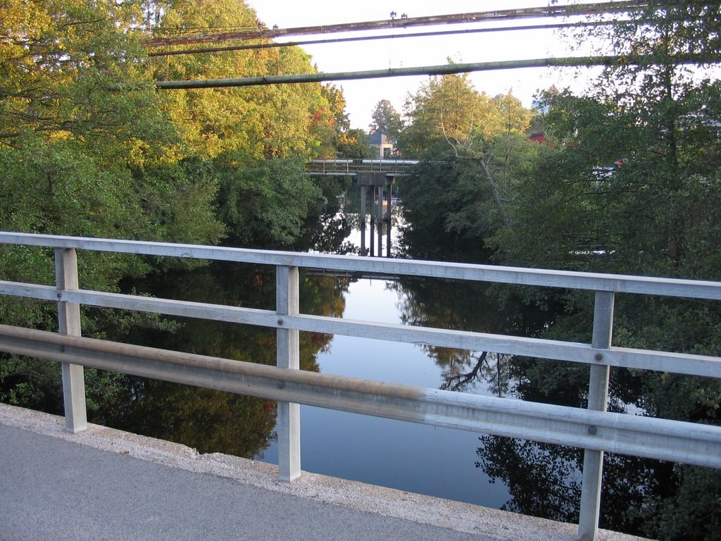 I checked my watch. It was approaching the time I knew was going to be sunset. I walked across Maxi carpark and started climbing Davids kulle (David's Hill), west of the Stadshus, to see if I could get any nice sunset photos like I had done the previous week at Sandvik. Here is a view looking southeast over the town. The old water tower from a previous post is visible on the left.
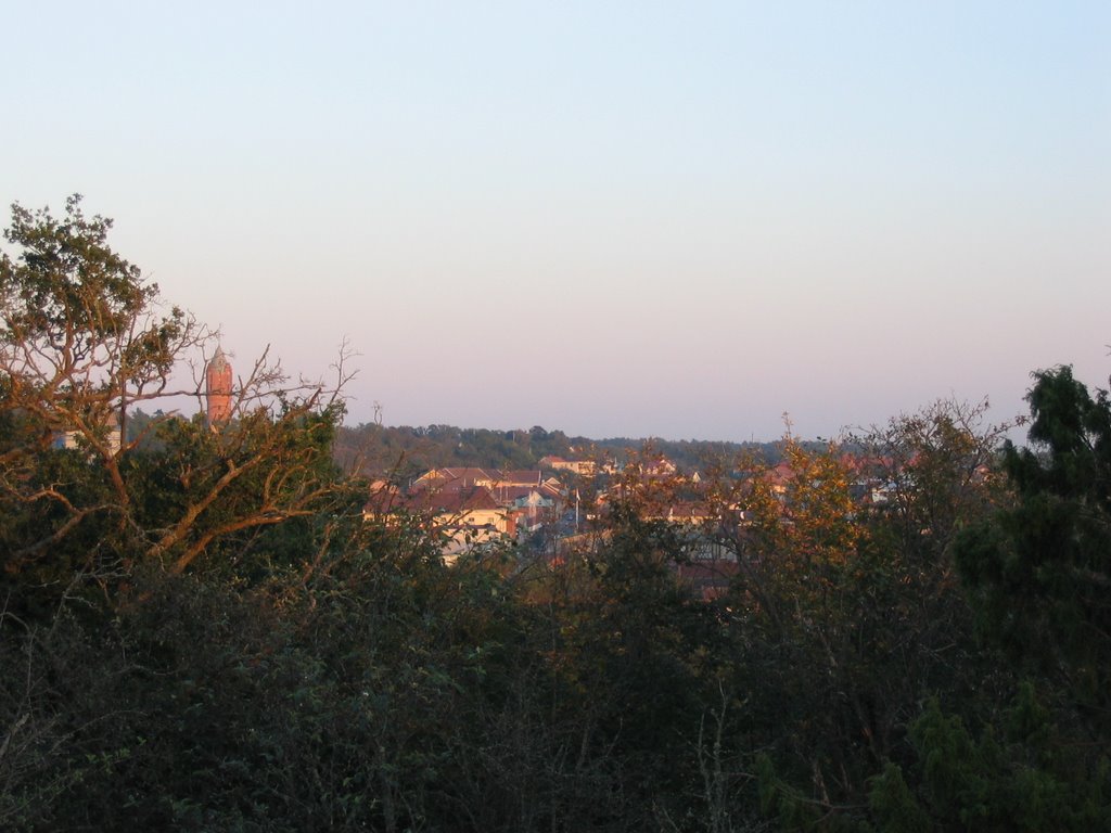
You could definitely tell höst (autumn) had arrived because of all the leaves on the ground.
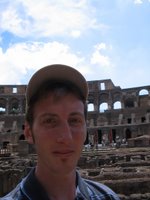
 Here is a silhouette of me projected onto one of the rocks of Davids kulle. The setting sun is behind me.
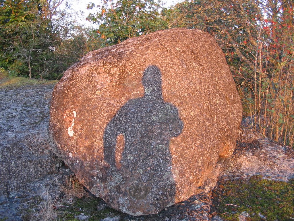 There it goes, over the horizon.
 Alas, I wasn't getting the stunning pictures like the previous Sunday. I headed home along Vierydsvägen. When I reached Härstorpssjön, this magnificent sight greeted me. It was so good, I had to take two photos of it.
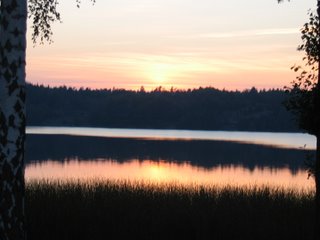
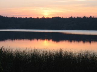
These are probably the photos of which I am most proud.
posted by Bruce @ 8:11 pm
![]()

<< Home